Autumn is the best hiking season near Seattle. The summer crowds go, the wildfire smoke that often spoils August clears, and on a good October day you get the Cascades at their sharpest. The trade-off is daylight: by November you are losing it before 5pm, and the snow line drops fast.
Trail statistics below are from Washington Trails Association, because getting these numbers right matters more in autumn than at any other time of year. A hike that runs long in July means a warm evening. The same hike running long in November means finishing in the dark.
Asahel Curtis Nature Trail — Easy
About 2 miles, almost flat. Exit 47 off I-90.
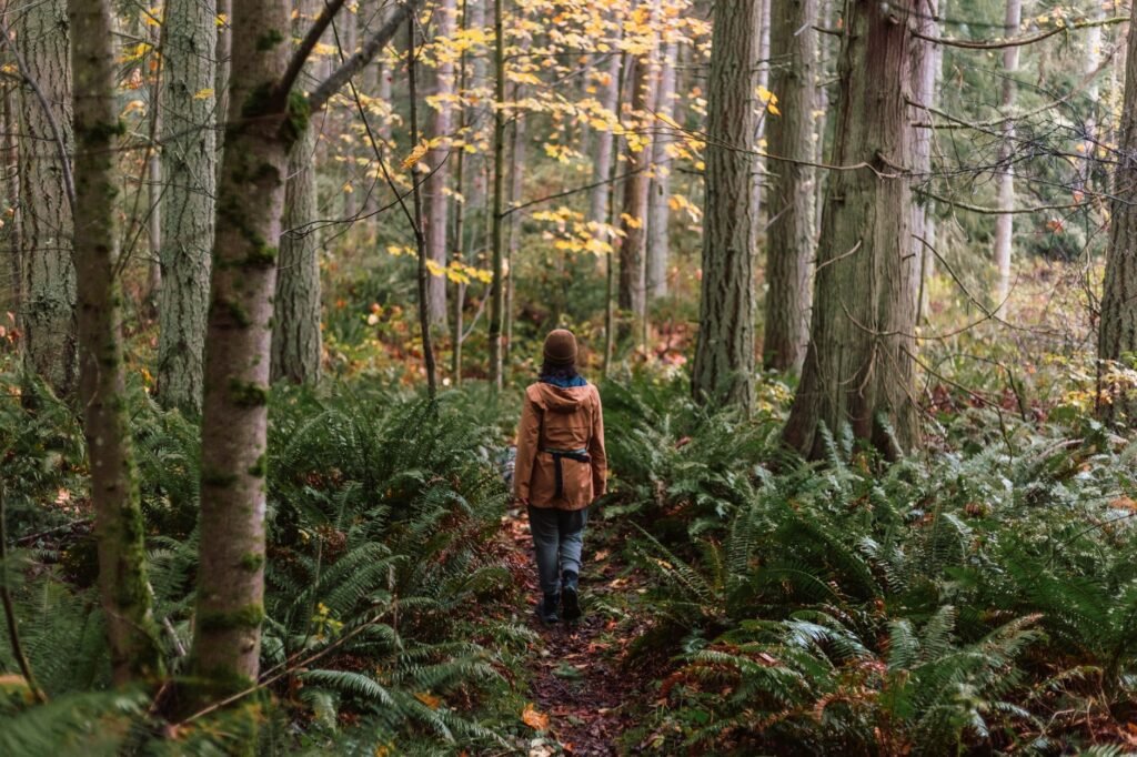
The gentlest option and the best use of a wet day. A short loop through genuine old-growth forest — Douglas fir and western red cedar, some of them centuries old — close to Snoqualmie Pass.
Rain improves this one. The moss saturates, the smell of the forest comes up, and most people stay home. Suitable for anyone with ordinary fitness and a reasonable choice if someone in the group is not up for a climb.
Snoqualmie Falls — Easy
About 1.4 miles round trip, roughly 250 feet of descent and climb back.
Most visitors only see the falls from the upper observation deck, which is free, takes ten minutes and is genuinely impressive — a single 268-foot drop.
The trail runs from the upper park down through forest to the lower viewing boardwalk at river level, where you look up at the whole fall. It is short but steep enough coming back up to count as exercise.
In autumn the flow is heavier than in summer without the thunder of spring melt, and the mist behaves differently in cold air. The upper lot fills on weekends; arrive before 10am.
Rattlesnake Ledge — Moderate
4 miles round trip, 1,160 feet of gain, high point 2,078 feet. Exit 32 off I-90 near North Bend, about 35 miles east of Seattle.
The most popular hike in the Seattle area for good reason. A steady, well-maintained climb through forest to a rock ledge looking out over Rattlesnake Lake, Mount Si and the Cedar River valley.
It is a maintained trail rather than a scramble — you will not need handholds — but the ledge itself is a large exposed rock with sheer cliffs on three sides. Approach the edge slowly, and hold onto children and dogs. This is the one genuine hazard on this list.
It is busy. Weekday mornings or an early start are the only way to have it quiet, and the car park does fill on autumn weekends.
West Tiger 3 — Moderate
About 5 miles round trip, 2,000 feet of gain, summit 2,522 feet. Issaquah, exit 20 off I-90.
The classic Seattle training hike, and the closest real climb to the city. Steady switchbacks through second-growth forest to a summit with views west over Issaquah and Lake Sammamish toward Puget Sound.
The Tiger Mountain complex has a large network of trails, including the much longer Tiger Mountain Trail, so read the junction signs — it is easy to commit accidentally to something considerably longer than you intended.
Close enough to Seattle that it is busy year-round, but autumn thins it noticeably.
Mailbox Peak — Hard
9.4 miles round trip, 4,000 feet of gain, summit 4,822 feet. Exit 34 off I-90 near North Bend.
This one needs stating plainly, because it is frequently misdescribed as a short hike. It is not. The current trail is 9.4 miles with 4,000 feet of climbing — roughly 850 feet per mile, with the final half-mile gaining about 960 feet on its own. Allow six to eight hours.
There is an old trail which is shorter and far steeper. It generated enough injuries and rescues, and enough erosion, that the Department of Natural Resources built the new route to replace it. Experienced hikers still use it. If you are not certain which category you are in, take the new trail.
The reward is real: a summit with the Cascade crest laid out and Mount Rainier dominating the southern horizon, plus the mailbox itself, which people have been leaving notes in for decades.
Snow sits on this peak well into spring and arrives early. From roughly November, microspikes are not optional.
Packing for Autumn
Layers, and more than you think.
- Base layer: merino or synthetic. Never cotton — it holds water and chills you
- Mid-layer: fleece or light insulation
- Shell: properly waterproof, not water-resistant
- Waterproof boots with grip. Trails stay muddy from October onward
- Hat and gloves, carried even on mild days — summits are colder and windier than trailheads
- Head torch. The single most forgotten item in autumn. Sunset is before 5pm by mid-November and the forest goes dark earlier
- Microspikes above about 2,000 feet from December. Cheap, light, and the difference between a walk and a slide
- Trekking poles if your knees object to long descents
The common mistake is underpacking on the assumption that effort keeps you warm. It does until you stop. Five minutes sitting down to eat with damp layers on a ridge in the wind is how people get into trouble.
Practical Notes
Most trailheads on I-90 require a Discover Pass or a Northwest Forest Pass depending on who manages the land — check which before you go, as tickets are issued.
Leave nothing visible in your car. Trailhead break-ins are common across the Snoqualmie corridor, and a car parked for six hours is a predictable target.
Check WTA trip reports from the past week before committing. They are written by people who were actually there and will tell you about blowdown, ice and closures before you drive out.
Tell someone your plan. Mobile coverage is poor to nonexistent on most of these trails.
Also read: Short hikes near Seattle and urban hikes you can reach by bus.
Trail distances, elevation gain and summit heights are from Washington Trails Association listings, checked October 2026. Conditions change weekly in autumn — read recent trip reports before travelling. Spotted an error? Tell us via the contact page.